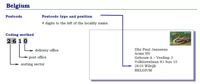
Postal codes in Belgium consist of four digits, with the first digit representing one of ten postal regions. The remaining three digits specify the exact post office or delivery area. Postal codes were introduced in Belgium in 1969 and have since become an essential component of efficient mail delivery. For example, the postal code for Brussels, the capital city, is 1000, with the first digit (1) representing the postal region and the remaining three digits identifying the specific delivery area. Postal codes are widely used in Belgium and are required when addressing letters and packages for delivery.
Belgium Regions Postal codes
Search by Map
Find the postal code or address for any location in Belgium with our interactive map of zip codes. Simply click on the desired location on the map.
Belgium Zipcode Format
Find Postal Code in Belgium
Each region in Belgium has its own unique postal code, and it’s important to have the correct code to ensure timely delivery of your mail. To find the correct code for your destination region, simply click on the region in the list above. If you’re unsure which region to choose, try our address lookup tool at the top of the page or use our interactive map to find your zip code.