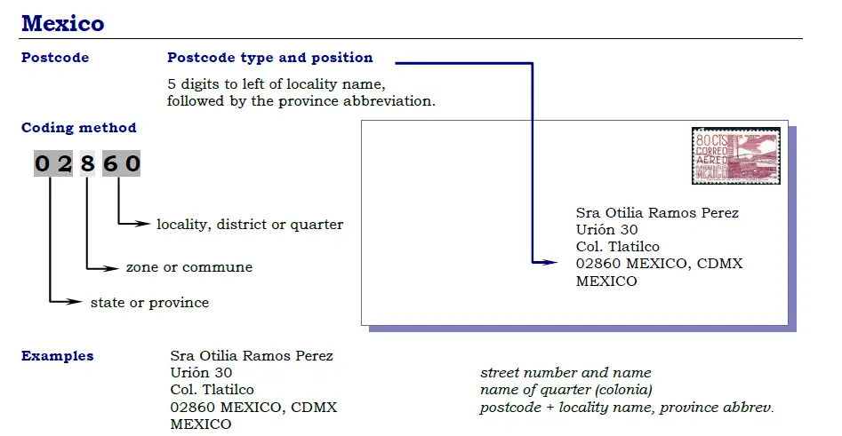
 Mexico uses a five-digit postal code system called “Código Postal” (CP) to help ensure mail and package delivery accuracy. The first two digits represent a state or part of a state, and the last three digits represent a postal zone within that state. Some areas may have additional digits to further narrow down the location. It’s important to use the correct postal code to ensure timely and accurate delivery.
Mexico Regions Postal codes
- Mexico
- Aguascalientes
- Baja California
- Baja California Sur
- Campeche
- Chiapas
- Chihuahua
- Coahuila De Zaragoza
- Colima
- Distrito Federal
- Durango
- Guanajuato
- Guerrero
- Hidalgo
- Jalisco
- Michoacan De Ocampo
- Morelos
- Nayarit
- Nuevo Leon
- Oaxaca
- Puebla
- Queretaro
- Quintana Roo
- San Luis Potosi
- Sinaloa
- Sonora
- Tabasco
- Tamaulipas
- Tlaxcala
- Veracruz De Ignacio De La Llave
- Yucatan
- Zacatecas
Search by Map
Find the postal code or address for any location in Mexico with our interactive map of zip codes. Simply click on the desired location on the map.
Mexico Zipcode Format
Find Postal Code in Mexico
Each region in Mexico has its own unique postal code, and it’s important to have the correct code to ensure timely delivery of your mail. To find the correct code for your destination region, simply click on the region in the list above. If you’re unsure which region to choose, try our address lookup tool at the top of the page or use our interactive map to find your zip code.