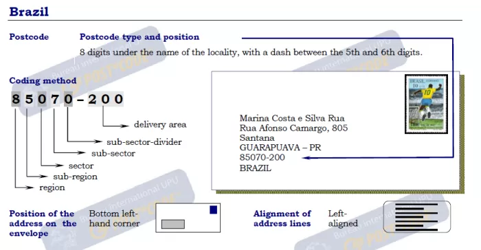
 Postal codes in Brazil are made up of eight digits, with the first five digits representing the state, region or city, and the remaining three digits representing a more specific location. The postal codes are used to facilitate the delivery of mail and parcels to the correct destination. The system was introduced in Brazil in 1971 and has since undergone several revisions to ensure accuracy and efficiency in mail delivery.
Brazil Regions Postal codes
- Acre
- Alagoas
- Amapa
- Amazonas
- Bahia
- Ceara
- Distrito Federal
- Espirito Santo
- Goias
- Maranhao
- Mato Grosso
- Mato Grosso Do Sul
- Minas Gerais
- Para
- Paraiba
- Parana
- Pernambuco
- Piaui
- Rio De Janeiro
- Rio Grande Do Norte
- Rio Grande Do Sul
- Rondonia
- Roraima
- Santa Catarina
- Sao Paulo
- Sergipe
- Tocantins
Search by Map
Find the postal code or address for any location in Brazil with our interactive map of zip codes. Simply click on the desired location on the map.
Brazil Zipcode Format

Find Postal Code in Brazil
Each region in Brazil has its own unique postal code, and it’s important to have the correct code to ensure timely delivery of your mail. To find the correct code for your destination region, simply click on the region in the list above. If you’re unsure which region to choose, try our address lookup tool at the top of the page or use our interactive map to find your zip code.